Randall’s Island belongs in the Bronx, say advocates
While New Yorkers wait for an appointed commission to carve the city up into a new set of districts for City Council representation, some South Bronx residents hope the new lines don’t mean they will lose control of Randall’s Island.
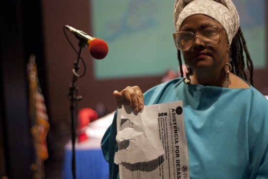
At a public hearing on Jan. 9 at Hostos Community College to discuss the city’s most recent proposal, several Mott Haven activists told the districting commission they oppose that body’s bid to transfer representation of the verdant strip of parkland in the East River from the Bronx to Queens. They fear losing control of the island’s 480 acres of parkland would mean less access to needed recreational venues for Bronxites.
The districting commission, which is comprised of fifteen mayoral and City Council appointees, will submit its latest proposal to the City Council on Jan. 30. The council can accept the proposal or send it back for more revisions.
Randall’s currently lies in the city’s 8th Council District, which comprises East Harlem and a portion of Mott Haven, represented by Councilwoman Melissa Mark-Viverito. The new map drawn up by the commission moves it to Councilman Peter Vallone Jr.’s 22nd district in Queens.
“Our children deserve access to that open space,” said Mott Haven activist Monxo Lopez, a mapmaker for the city’s Office of Emergency Management, addressing some 50 attendees.
“You give the island to Queens like they’re the king of Spain,” he told the commission.
In addition to recreational venues, there is a homeless shelter on the island that houses nearly 1,000 homeless adults, and a state-run psychiatric hospital.
About a dozen community activists came to the meeting armed with a plan of their own, an alternative map they call the Common Sense Bronx Plan. Community Board 1 member Mychal Johnson, who created and presented the map, said his plan heightens representation for four Bronx council districts and calls for Randall’s to stay put.
“When you’re shifting around population numbers, someone will be left out,” said Johnson. But, he told the commission, his plan “preserves fair and effective representation” for South Bronx communities.
Several speakers argued that retaining Randall’s makes sense because it is more easily accessible for Bronx and Manhattan residents than for those who live in Queens, and has long been a needed destination for Bronxites who lack green space in their neighborhoods. Several private schools and athletic leagues use the island’s facilities, the speakers said.
“We’ve always gone to Randall’s Island,” said David Rodriguez, president of the Longwood-based United Hispanic Construction Workers, explaining his group frequently takes its workers to the island for a break from their work stresses. Rodriguez and others fear that without political representation, opportunities for Bronxites seeking recreational escapes could be curtailed.
“Who controls parkland that is contiguous with the Bronx is very important,” said Morgan Powell, a borough historian and landscape designer, adding he is concerned about “the idea that communities do not control parks and open spaces.”
Some elected officials argued for taking local representation a step further. They urged the commission to give the Bronx an additional seat on the City Council, insisting that the borough’s population growth justifies increased representation. The Bronx’s population rose nearly four percent between 2000 and 2010, to almost 1.4 million. During that span, the population of the city rose barely two percent.
“The population in the Bronx is enough to justify 8.7 districts. Go back to the table and give us that,” said Councilwoman Maria del Carmen Arroyo, whose district currently includes much of Mott Haven and all of Hunts Points and Longwood.
Under the new lines the commission is proposing, Arroyo would lose most of her Mott Haven base and a small swath of Longwood, encompassing Southern Boulevard as far north as Longwood Avenue.
“It breaks my heart to have to give up areas that I’ve been representing for eight years,” said Arroyo.
State Assemblyman Jeffrey Dinowitz agreed the borough should get an additional Council member.
“The Bronx as a whole should not be underrepresented,” he said.
“We want to make sure our culture is being preserved,” said Julien Terrell, a community organizer who lives in Mott Haven.
The city charter requires the adjustment of district boundaries to reflect changes in the city’s population every 10 years. Wednesday’s hearing was the third in a series allowing the public to comment on the commission’s proposals.
Residents can create their own maps electronically by clicking here.

All you need to do is look at a map. Randall’s Island is for all intents and purposes the South South Bronx. As Bronxites, we should focus on increased access to this public space.
“The city charter requires the adjustment of district boundaries to reflect changes in the city’s population every 10 years.” – What population changes in Manhattan, the Bronx or Queens would justify handing Randalls Island over to Queens? East Harlem still has the same population as it did in 2003. Mott Haven still has the same population it had in 2003. Oh… that’s right. Astoria, which is currently undergoing Brooklyn-style gentrification is now where the fast moving new money is. So, they get Randalls island for themselves. Right, I get it. So what now, we turn all of Randalls island into the new McCarren park?